CYCLING TRIPS
Maira Valley and Colle d’Esischie
Total distance: 84,69 km
Total distance: 84.69 km
Max elevation: 2369 m
Min elevation: 608 m
Download file: Café%20tour%20.gpx
Max elevation: 2369 m
Min elevation: 608 m
Grana & Stura Valleys
Total distance: 89,5 km
Total distance: 54.71 km
Max elevation: 930 m
Min elevation: 530 m
Download file: Café%20tour%20journée%201%20(1).gpx
Max elevation: 930 m
Min elevation: 530 m
Valle grana e le sue bellezze
Distanza totale: 54,73 km
Total distance: 89.49 km
Max elevation: 2493 m
Min elevation: 564 m
Download file: Cafè%20tour%20journée%202.gpx
Max elevation: 2493 m
Min elevation: 564 m
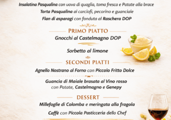
Chamin Classic – Montemale
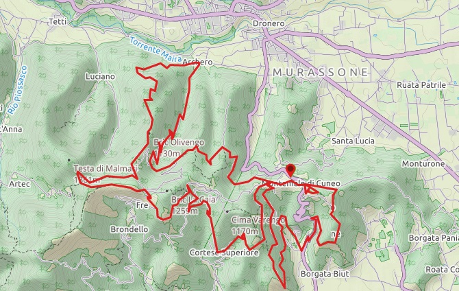
| Starting point: | Montemale, Town Hall |
| Altitude at start/arrival: | 920 m s.l.m. |
| Length: | 34 km |
| Total elevation gained: | d+ 1430 m |
| Max altitude: | 1230 m s.l.m. |
| Type of itinerary: | circuit |
| Difficulty: | medium, 5 Km sealed, 29 Km dirt |
Rampignado – The Partisans’ paths
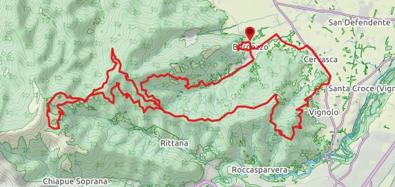
| Starting point: | Bernezzo, Town Hall |
| Altitude at start/arrival: | 520 m s.l.m. |
| Length: | 46,7 km |
| Total elevation gained: | d+ 1100 m |
| Max altitude: | 1541 m s.l.m. |
| Type of itinerary: | circuit |
| Difficulty: | Medium |
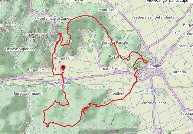
Tour della media valle – Anello di Rocca Stella
| Starting point: | Valgrana, piazza Galimberti |
| Altitude at start/arrival: | 640 m s.l.m. |
| Length: | 28,8 km |
| Total elevation gained: | d+1200 m |
| Max altitude: | 1597 m s.l.m. |
| Type of itinerary: | circuit |
| Difficulty: | medium, 13.5 Km sealed, 15.3 Km dirt |
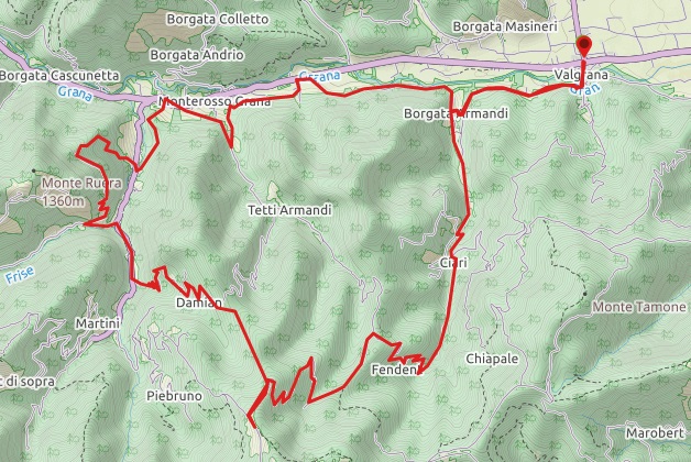
L’adrèch e l’Ubai
| Starting point: | Valgrana, ports fields |
| Altitude at start/arrival: | 640m s.l.m. |
| Length: | 24 km |
| Total elevation gained: | d+ 1140 m |
| Max altitude: | 1110 m s.l.m. |
| Type of itinerary: | circuit |
| Difficulty: | medium, 9 Km sealed, 15 Km dirt |
Lower-altitude hamlets
| Starting point: | Monterosso Grana, campground “Rocca Stella” |
| Altitude at start/arrival: | 770 m s.l.m. |
| Length: | 22 km |
| Total elevation gained: | d+ 800 m |
| Max altitude: | 930 m s.l.m. |
| Type of itinerary: | circuit |
| Difficulty: | medium,11 Km sealed, 11 Km dirt |
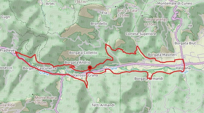
La Vìo dell’Adrech – Pradleves
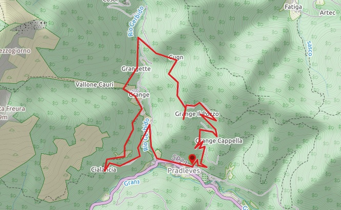
| Starting point: | Pradleves, Town Square |
| Altitude at start/arrival: | 800 m s.l.m. |
| Length: | 9 km |
| Total elevation gained: | d+ 360 m |
| Max altitude: | 1127 m s.l.m. |
| Type of itinerary: | circuit |
| Difficulty: | medium-hard, 1.8 Km sealed, 7.2 Km dirt |
 This is us! The story of our little house is a story of happy and proud men and women that has lasted 85 years.