Barma Granda and Sites of Community Importance
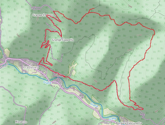
| Starting point: | Pradleves, Town Hall |
| Altitude at start/arrival: | 800 |
| Time: | 4h return |
| Cumulative elevation gain: | 350 m |
| Max altitude: | 1150 m |
| Type of itinerary: | circuit with minimal backtracking |
| Difficulty: | E (normal, Hiker). No difficulties worth noting. Water can be scarce on the trail in some seasons. |
Bivacco Rousset (small mountain hut)
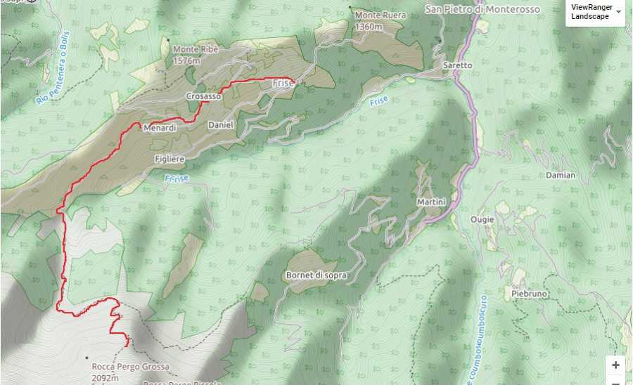
| Starting point: | Frise |
| Altitude at start/arrival: | 1300 |
| Time: | 4h return |
| Cumulative elevation gain: | 600m |
| Max altitude: | 1850 |
| Type of itinerary: | return through the same route |
| Difficulty: | E (normal, Hiker). No technical difficulties. Pay extra attention when foggy. After you ford the small stream when embarking, the trailhead might be hard to spot because of the tall grass. |
Il Cammino di San Magno (The Way of St. Magnus)
| Starting point: | Campomolino, Town Hall |
| Altitude at start/arrival: | 1155 |
| Time: | 5h return |
| Cumulative elevation gain: | 700m |
| Max altitude: | 1750 m |
| Type of itinerary: | return through the same route |
| Difficulty: | E (normal, Hiker). No difficulties worth noting. Easy access to the main road. |
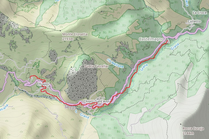
The ice cave – Pertus d’la Patarassa
| Starting point: | Santuario di San Magno (St. Magnus’ Shrine), Castelmagno |
| Altitude at start/arrival: | 1750 |
| Time: | 4h30 return |
| Cumulative elevation gain: | 800m |
| Max altitude: | 2190 |
| Type of itinerary: | return through the same route |
| Difficulty: | EE (Experienced hikers). No technical difficulties, just some steep sections after the primary ridge. |
La Via del Dusu
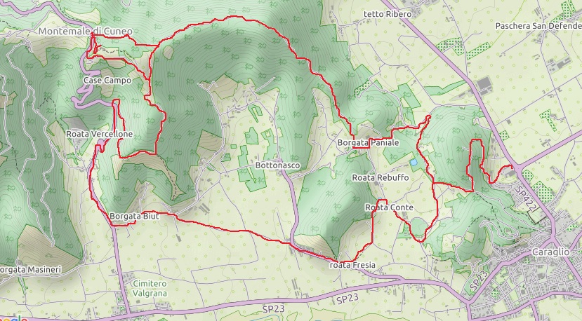
| Starting point: | Caraglio, Filatoio Rosso (Red Spinning-house) |
| Altitude at start/arrival: | 535 |
| Time: | 6h |
| Cumulative elevation gain: | 430 m |
| Max altitude: | 970 |
| Type of itinerary: | circuit |
| Difficulty: | E (normal, Hiker). No technical difficulties. Finish the hiking circuit or return via the same trail. A restaurant is available in Montemale. |
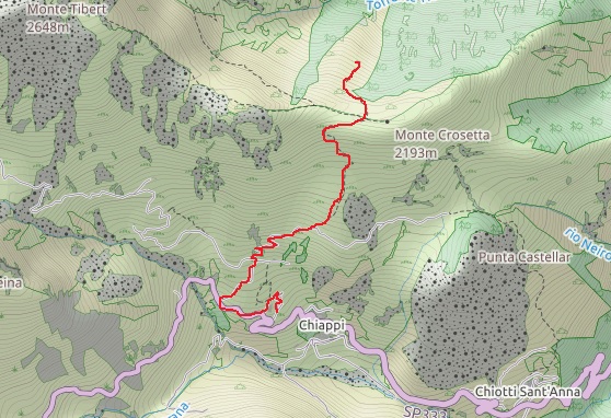
The hamlets of crossed destinies
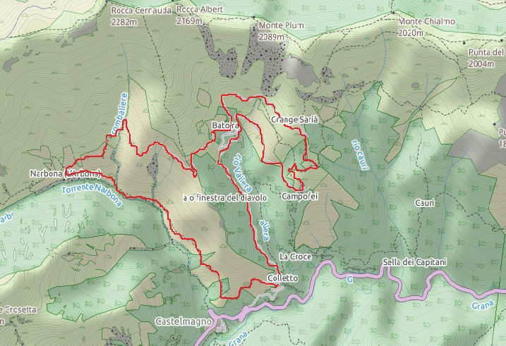
| Starting point: | Colletto, Castelmagno |
| Altitude at start/arrival: | 1300 |
| Time: | ?H |
| Cumulative elevation gain: | 700m |
| Max altitude: | 1750 |
| Type of itinerary: | circuit |
| Difficulty: | EE (Experienced Hikers). No highly technical difficulties, but certain segments with slippery rocks and exposed sections require some care. |
Le Laouziere – Slate mines
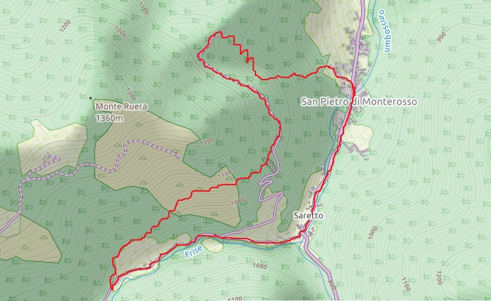
| Starting point: | San Pietro Monterosso, Church square |
| Altitude at start/arrival: | 820 |
| Time: | 3h |
| Cumulative elevation gain: | 180m |
| Max altitude: | 880 m |
| Type of itinerary: | circuit |
| Difficulty: | E (normal, Hiker). No technical difficulties, the first 2 Km are on a sealed road. Watch your step when entering the mines. |
San Matteo – Partisans’ paths
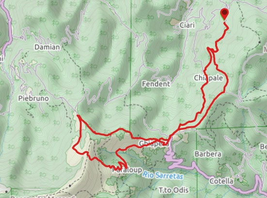
| Starting point: | San Matteo, near Valgrana, Church square |
| Altitude at start/arrival: | 1020 |
| Time: | 6h |
| Cumulative elevation gain: | 850m |
| Max altitude: | 1640 m |
| Type of itinerary: | circuit |
| Difficulty: | E (normal, Hiker). No technical difficulties. Some care required in case of fog. Hikers can stop at the mountain hut Rifugio Paraloup. |
 This is us! The story of our little house is a story of happy and proud men and women that has lasted 85 years.